Tohoku refers to the northeastern region of Honshu, the main island of Japan. It is made up of six prefectures: Akita, Aomori, Fukushima, Iwate, Miyagi, and Yamagata. Given its location, this region is one of the first to welcome the colors of fall. Here are five of the best places to enjoy them.
Oirase Stream
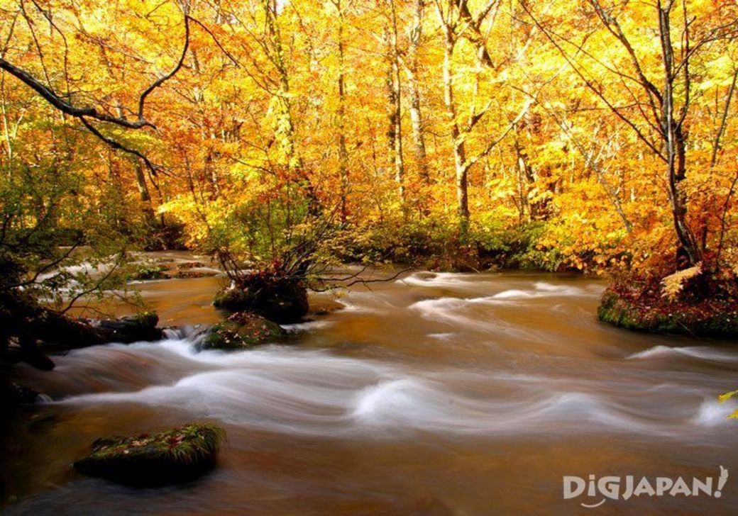

Though beautiful any time of year, Oirase Stream in Aomori Prefecture takes on an almost magical quality during the autumn months. The brilliant color of the autumn leaves creates a stunning contrast between the green of the moss covered rocks and foaming white of the fast-flowing stream. The stream flows approximately 14 kilometers (approx. 8.7 miles) from Mt. Yakeyama to Lake Towada. If you’re the outdoorsy type, follow the walking trail built along the stream and take in some incredible fall scenery.

Address: Okuse, Towada-shi, Aomori-ken
Peak foliage: mid-October thru late-October
Access: take the JR Bus bound for Towadako from JR Hachinohe Station to the Yakeyama bus stop (approx. 90 min)
Website: http://www.en-aomori.com/scenery-002.html
Bandai Azuma Skyline

Rent a car and take a scenic drive on the Bandai Azuma Skyline in Fukushima Prefecture. Following this 28.7 kilometers (17.8 miles) sightseeing route will take you through some of Fukushima’s most stunning spots for fall leaves in about an hour. One must-see area is the Tsubakuro Valley. During the peak season, this valley is filled with fiery reds and oranges. You can park your car on the bridge that spans the valley which makes it a great place to take some amazing pictures.
Address: Takayu Machiniwasaka~Tsuchiyu Onsen-machi, Fukushima-shi, Fukushima-ken
Peak foliage: early-October thru mid-October
Access: traveling in the direction of Takayu Onsen on the Fukushima Nishi Interchange, take the exit for Japan National Route 115. Next, take the exit for Prefectural Road 5 and then the exit for Prefectural Road 70. After entering Japan National Route 115, it is approximately 15km (9.3mi) to the Bandai Azuma Skyline.
Website: http://www.tif.ne.jp/lang/en/sightseeing/topic.html?id=42&category=4
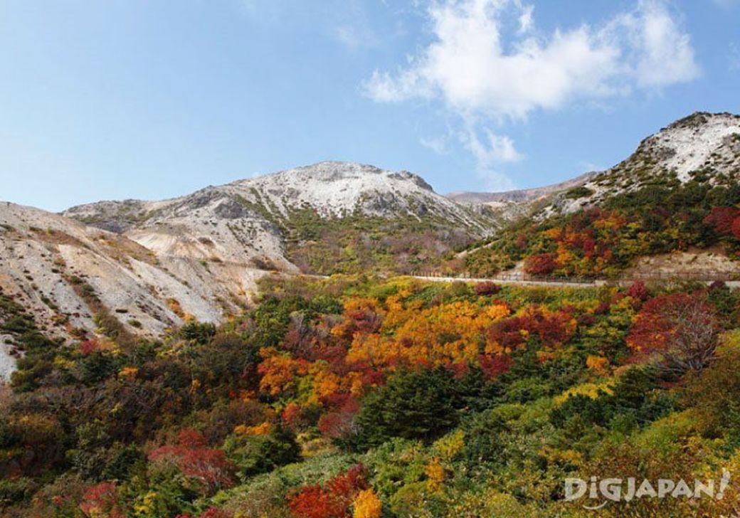
Mt. Zao
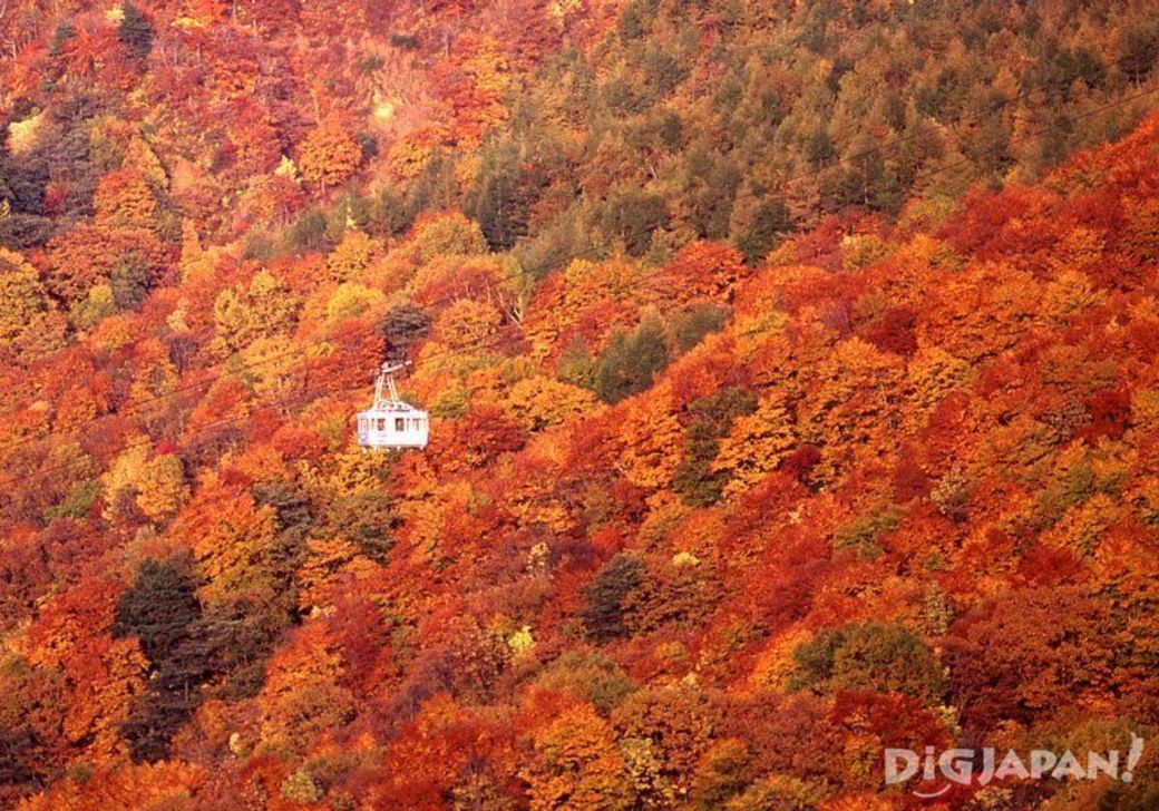
While possibly most famous for the "snow monsters" that appear in the winter, Mt. Zao in Yamagata Prefecture is also home to a strikingly beautiful display of fall colors. You can enjoy the scenery from a variety of trekking courses in the area, or get a spectacular aerial view from the Zao Ropeway.

Address: Yamagata-shi, Yamagata-ken
Peak foliage: mid-October thru late-October
Address: 229-3 Zao Onsen, Yamagata-shi, Yamagata-ken
Hours: 8:30am~5:00pm
*Ending time changes seasonally. See website for details.
Fee: see website for details
Access: take the Yamako Bus bound for Zao Onsen from JR Yamagata Station (approx. 37 min). The ropeway station is 10 min walk from the last bus stop.
Website: http://zaoropeway.co.jp/en/index.html
Mt. Kurikoma

In addition to Iwate Prefecture, the 1,626.5 meters (5,336.3 feet) high Mt. Kurikoma also extends into the prefectures of Akita and Miyagi. The fall colors of this mountain make it a favorite among Japanese hiking enthusiasts. One of the attractions of visiting Mt. Kurikoma from the Iwate side is Showako. The bright, unusual color of this crater lake makes for a gorgeous contrast with the fall colors of the mountain.

Address: Genbi-cho, Ichinoseki-shi, Iwate-ken
Peak foliage: early-October
Access: take the Iwate-ken Kotsu Bus bound for Sukawa Onsen departing from bus stop No. 9 from the West Gate of JR Ichinoseki Station and get off at the Sukawa Onsen stop (approx. 90 min). It takes approximately 50 minutes to hike from the bus stop to Showako Lake.
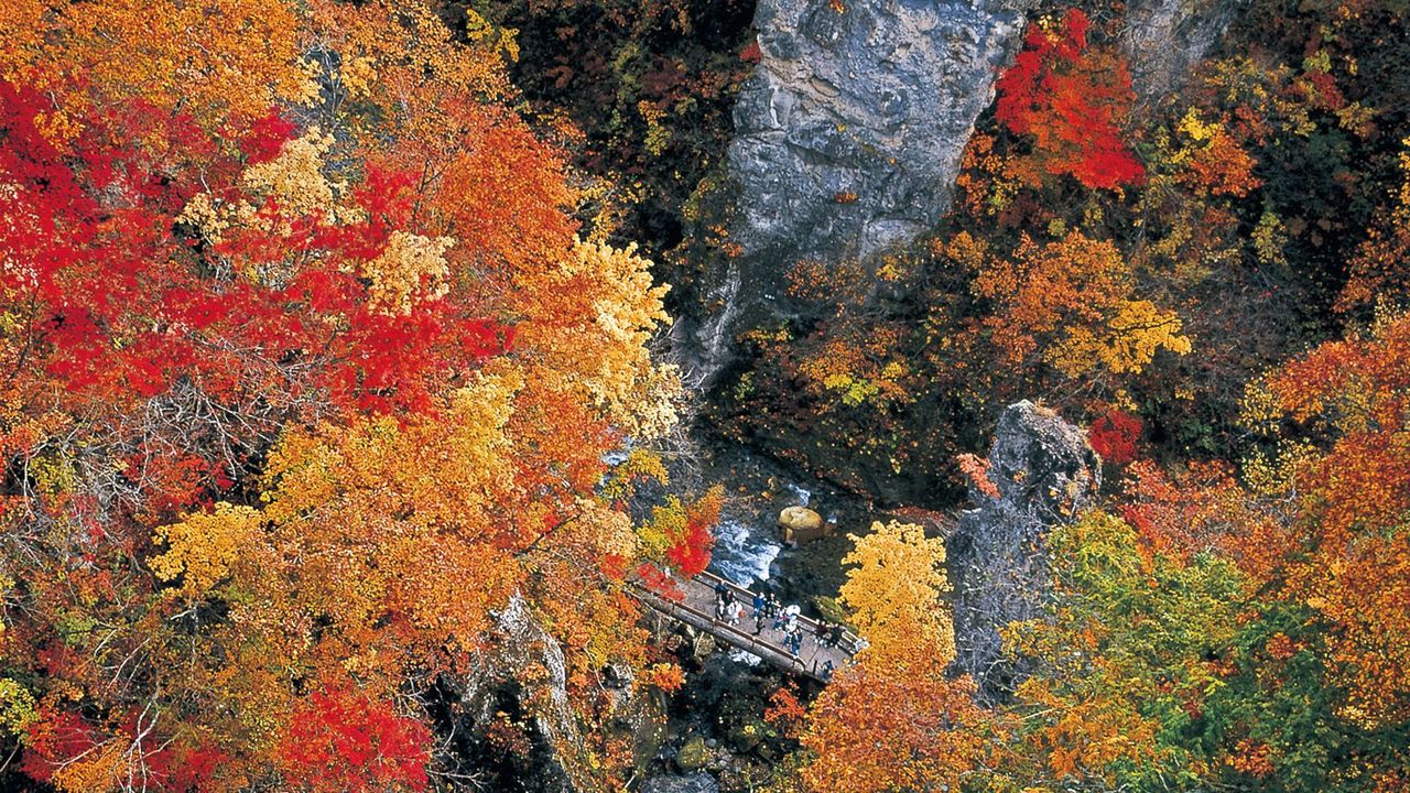
Naruko Gorge

Naruko Gorge in Miyagi Prefecture is an impressive natural formation, plunging downward for nearly 100 meters (328 feet) and stretching for nearly 2.5 kilometers (1.6 miles). The colorful fall foliage scattered among the bright green of pine trees creates a charming, multicolored landscape. You can also get a great view of the Ofukazawabashi Bridge from the Narukokyo Rest House.
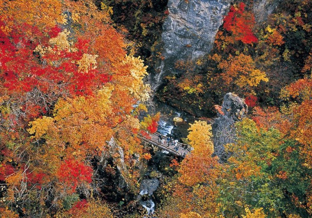
Address: Naruko Onsen Shitomae, Osaki-shi, Miyagi-ken
Peak foliage: late-October thru early-November
Access: 5 min by taxi from JR Naruko Onsen Station to the entrance of the walking trail
Website: http://www.miyagi-kankou.or.jp/tourist_infomation/en/
(Written by Rachael Ragalye/DiGJAPAN!)
Related articles from DiGJAPAN! How to Have Fun in Osaka Tenjinbashi-suji ShotengaiInside the Chura-Umi Room at Hotel Gracery Naha
Should I Get a Japan Rail Pass